Ampli range of ultra fine lime
Amplical is a source of calcium carbonate (CaCO3) - containing 30% Ca - with a high porosity and surface area to volume ratio. It is specifically formulated with a high carbon content and natural chelates that act as biostimulants for improved nutrient and calcium uptake and plant growth.
Amplical's ability to effectively alter soil conditions is directly related to the applied product's size and limestone quality. Smaller particles increase the total surface area exposed to the soil's acidity, providing the necessary neutralization benefits to raise soil pH and improve soil conditions. Smaller particle size contributes to faster breakdown and neutralization results than other lime applications.

Amplimag is a source of magnesium carbonate (MgCO3) and magnesium silicate (MgSiO3) – containing 22% magnesium - with a high porosity and surface area to volume ratio.
Both Amplical and Amplimag are highly effective liming products that improve soil's physical and chemical properties. The ability of Amplical as well as Amplimag to effectively alter soil conditions is directly attributable to the applied products’size and lime quality. As a result of the finer particles of Amplical and Amplimag, a larger volume of soil benefits from their neutralizing effect per application. The size of these smaller particles contributes to faster nutrient uptake and neutralization results.
ADVANTAGES
Improved handling, transportation and application
Reduced product loss because of less dust
Custom made nutrient matrix
More predictable results
Mitigation of dust and windblown material
Soil analysis by manna worx

Contact manna worx
WhatsApp: 016 004 0461
Email: grond@grond.co.za
SWAT MAPS
What are SWAT MAPS?
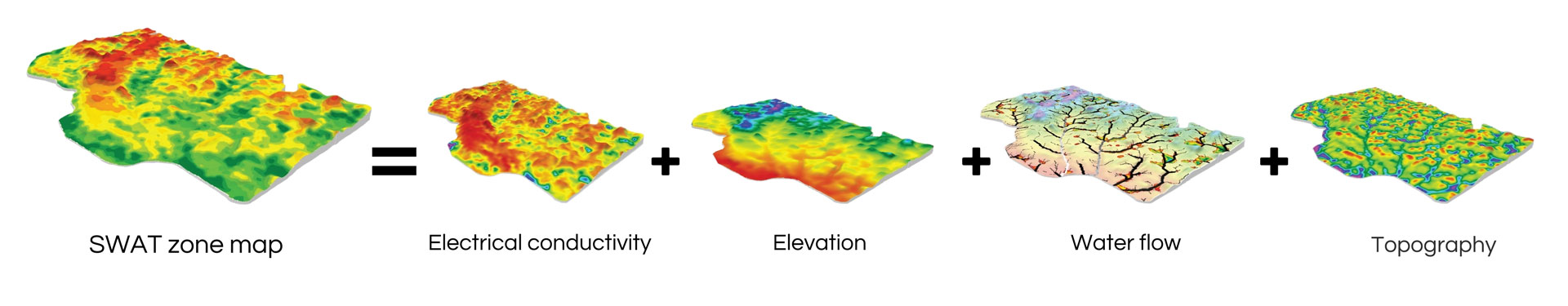
SWAT (an acronym for Soil, Water And Topography) MAPS are patented, high-resolution soil foundation maps used to execute variable-rate fertilizer, seed, soil amendment, herbicide and precision water management.

Soil
Factors such as soil texture, soil organic matter levels, topsoil depth and salinity all impact yield and fertilizer response.
Water
Water has the most profound influence on yield and fertilizer response. SWAT MAPS delineate dry versus wet areas of the field.
Topography
Topography is a detailed representation of the natural shapes and features of a certain field and influences like moisture erosion, organic matter levels, pH and soil fertility levels.
The
process
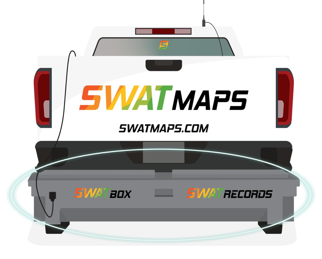
The SWAT BOX is an autonomous soil mapping hardware system which collects data.
SWAT ZONES
1+2 Eroded knolls, hills, sands, lowest organic matter, dry
3+4 Shoulder slopes, upper slopes, water runs off
5+6 Mid-slopes, flat areas, field average
7+8 Toe slopes, lower flats
9+10 Depressions, saline areas, higher clay, peat/muck, high organic matter, wet (water collecting)


SWAT RECORDS is the software that runs the entire SWAT ecosystem. You can download the app on your computer, tablet or cellphone.
The SWAT RECORDS app is free of charge to all subscribed farmers.
The key functions of SWAT RECORDS are: